Feb. 8, 2024
VCU Rice Rivers Center provides training to Chickahominy Tribe to help preserve ancestral land
Share this story
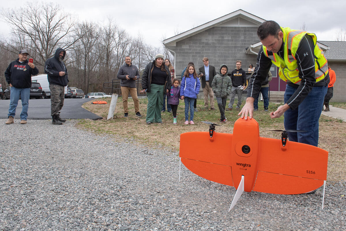
Outside the Chickahominy Indian Tribe’s Tribal Center in Providence Forge, children are gathered around Will Shuart, watching with interest as he demonstrates how to launch and pilot a drone.
“We’re ready for takeoff,” says Shuart, an assistant professor at the Virginia Commonwealth University Rice Rivers Center and a geographer with the U.S. Army Corps of Engineers. “All you have to do is swipe here. … And OK, there it goes!”
The bright orange drone lifts off and begins a crisscrossing flight pattern at 284 feet, gathering photos and video that can be used to generate precise maps of the area below, accessible via a phone app called GeoLocator.
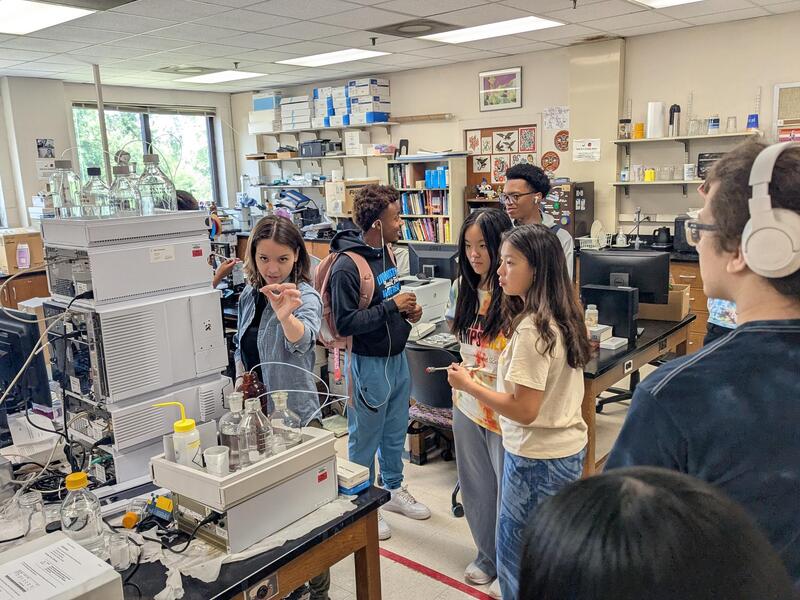
Shuart’s demonstration was part of a daylong training held last week by Rice Rivers Center faculty and graduate students for citizens of the Chickahominy Tribe. The training included hands-on instruction in drones, GIS mapping and other technology that the Chickahominy people can use to monitor and protect their 944-acre ancestral property called Mamanahunt, located in the lower Chickahominy River watershed in Charles City County.
In 2022, the Rice Rivers Center, which is part of VCU Life Sciences, began working on a project to conduct an environmental analysis of the property, which had been recently reacquired by the Chickahominy Tribe. The researchers have been gathering data on the property, including on vegetation and wildlife, as well as potential threats such as invasive species, shoreline erosion and saltwater intrusion due to sea level rise.
“It’s a beautiful property,” said Dana Adkins, environmental director for the tribe. “We knew it had a great amount of cultural significance. It’s one of our settlements, a village site during the time of first contact with the English around 1607. So we knew there is a lot of history there. What we don’t know is what is there environmentally. What condition is the ecosystem in? Are there areas that need to be improved? Are there areas that are in great shape but just need to be maintained?”
The Rice Rivers Center, he said, has been providing a baseline of environmental data collected via drones, LiDAR (light detection and ranging), hyperspectral sensors and other technology that will enable the tribe to steward the land for generations to come.
“Working with Rice, they have the experts. We have a beautiful site,” Adkins said. “Coming together, we can find out exactly what we have and use that information going forward to help us make decisions to best protect it.”
Ed Crawford, Ph.D., deputy director of the Rice Rivers Center and principal investigator on the project, said the goal is to empower the Chickahominy Tribe to become citizen scientists by providing training and tools to collect important data.
“It will help them make informed decisions about Mamanahunt,” he said. “But they can use it for anything. They can [use an app called Field Maps] and if they see an invasive species, they can take a picture of it. They can make a GPS point. They can make notes in the program, monitor it and work up a management strategy to either leave it alone if it’s not very pernicious or remove it if it’s something they don’t want there.”
The technology, Crawford added, will also help provide insight into the property’s history. For example, it could be used to map archaeological sites. And it could be used to map the site’s remaining “marker trees,” which were bent roughly 400 years ago to grow in certain ways to provide directions.
The project is funded by a unique partnership of the Rice Rivers Center, the Virginia Department of Environmental Quality and the private sector.
Greg Garman, Ph.D., director of the Rice Rivers Center, said the partnership with the Chickahominy Tribe is consistent within the center’s longtime commitment to engage with Virginia’s federally recognized tribes in environmental stewardship.
“We have a 20-year history of engagement with the Chickahominy, as well as more recent histories with the Pamunkey, Upper Mattaponi and other tribal nations,” Garman said. “We hope to learn from [from the training] and replicate such citizen geoscience workshops for other underserved communities.”
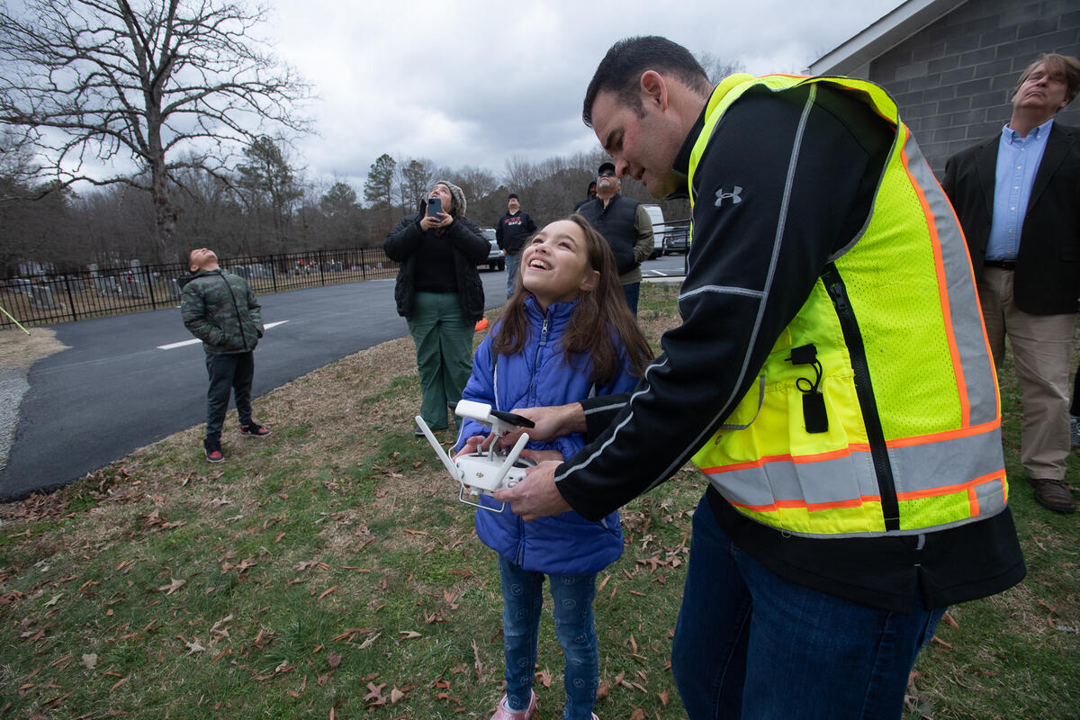
Another important component of the recent training was the opportunity for Chickahominy youth to get hands-on experience with emerging technology.
“My hope is that it will spike interest in our kids and maybe get some excited about [studying science] and postsecondary education,” Adkins said. “Secondly, we would like for those kids to take that education and be able to bring it back here, and be our own in-house experts.”
Subscribe to VCU News
Subscribe to VCU News at newsletter.vcu.edu and receive a selection of stories, videos, photos, news clips and event listings in your inbox.